
Table of Contents
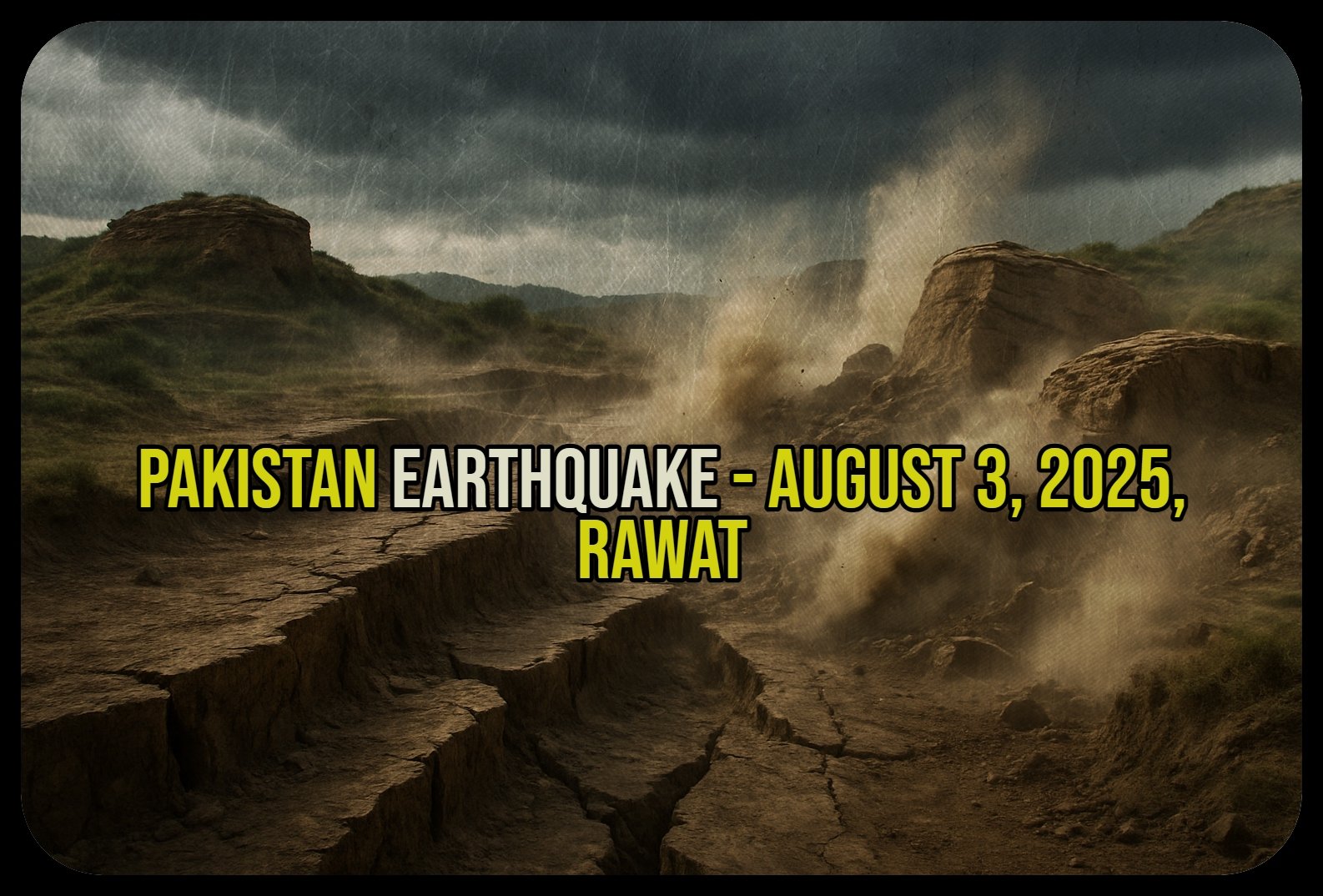
Analysis of the August 3, 2025, Rawat Earthquake and the Seismotectonic Vulnerability of the Potohar Plateau
Executive Summary
In the early hours of August 3, 2025, a moderate earthquake struck the Potohar Plateau region of northern Pakistan, centered near the town of Rawat. While official Pakistani agencies reported the magnitude as 5.1, other international seismological centers registered it between M4.8 and M4.9. The event was characterized by its shallow focal depth of approximately 10 kilometers, which contributed to its being widely felt across the Islamabad Capital Territory, major cities in Punjab, and parts of Azad Jammu & Kashmir. Despite causing considerable public alarm—a reaction amplified by a separate, deeper earthquake that occurred less than 24 hours prior—the August 3 tremor resulted in no reported fatalities or significant structural damage.
This report provides a comprehensive analysis of the August 3, 2025, Rawat earthquake, situating it within its complex seismotectonic and operational context. The event’s primary significance lies not in its physical impact, but in what it reveals about the persistent and localized seismic hazards facing a strategically vital and densely populated region of Pakistan. The earthquake serves as a critical case study of the risk posed by shallow, active fault systems, such as the Rawat Fault, which underlie the Islamabad-Rawalpindi metropolitan area.
Furthermore, the official response to the earthquake offers valuable insights into the evolving capabilities of Pakistan’s national disaster management framework. The National Disaster Management Authority (NDMA) was, at the time, fully engaged in managing a severe and high-fatality monsoon flood season. The agency’s ability to issue a prompt, technically detailed, and coherent response to this sudden “no-notice” seismic event, while simultaneously handling a large-scale hydrometeorological crisis, demonstrates a notable level of institutional resilience and strategic communication. This report deconstructs the seismic event, analyzes its societal impact and the official response, explains the underlying geological drivers, and evaluates the performance of the disaster management system within a challenging multi-hazard environment. It concludes with actionable recommendations for enhancing regional resilience through improved public education, targeted enforcement of building codes based on micro-zonation studies, and the institutionalization of multi-hazard response protocols.
Section 1: The August 3, 2025, Rawat Earthquake: A Multi-Agency Analysis
1.1 Seismic Signature and Event Parameters
The seismic event of August 3, 2025, was recorded and analyzed by multiple national and international seismological agencies, resulting in a consistent picture of its location and depth, albeit with minor variations in reported magnitude. This discrepancy is a common feature of earthquake reporting, stemming from differences in sensor networks and analytical models, but its handling also reflects national communication strategies.
According to official sources within Pakistan, including the National Seismic Monitoring Centre (NSMC) and a formal press release from the Press Information Department (PID), a magnitude 5.1 earthquake occurred at 00:10 Pakistan Standard Time (PST).1 The epicenter was pinpointed at coordinates $33.45^{\circ}$N, $73.31^{\circ}$E, placing it approximately 15 kilometers east-southeast of Rawat, a town near the twin cities of Rawalpindi and Islamabad.2 This data represents the authoritative government position within Pakistan.
In contrast, agencies outside Pakistan reported slightly lower magnitudes. India’s National Centre for Seismology (NCS) registered the event as a magnitude 4.8 earthquake occurring at 00:40 Indian Standard Time (IST), which corresponds to 00:10 PST.4 The NCS located the epicenter at slightly different coordinates of $33.36^{\circ}$N, $73.23^{\circ}$E.4 Meanwhile, the global earthquake tracking service EarthquakeTrack.com reported a magnitude of
4.9 with an epicenter near Gūjar Khān, a city in the same vicinity.8
The decision by Pakistani authorities to exclusively disseminate the M5.1 figure from its own NSMC is significant. It represents a deliberate and effective strategy of information sovereignty in a crisis. By establishing a single, authoritative national source of truth, the government mitigates potential public confusion that could arise from conflicting media reports citing foreign agencies.5 This approach reinforces the credibility of national institutions like the NDMA and the NSMC and ensures a clear, consistent message is delivered to the affected population, a core principle of effective disaster risk communication.11
Despite the variance in magnitude, there was a firm consensus across all reporting agencies on the earthquake’s focal depth. The event was unanimously classified as a shallow earthquake, with a depth of just 10 kilometers.2 The shallow origin of an earthquake is a critical factor in determining its impact. Seismic energy from a shallow event has less distance to travel to the surface, meaning it attenuates less. This results in stronger and more intense ground shaking in the epicentral region compared to a deeper earthquake of the same magnitude, which would distribute its energy over a much wider area.
Table 1: Comparative Seismic Parameters of the August 3, 2025, Rawat Earthquake
| Parameter | Pakistan (NSMC/PID) | India (NCS) | International (EarthquakeTrack.com) | |
| Magnitude | 5.1 | 4.8 | 4.9 | |
| Date (UTC) | 2025-08-02 | 2025-08-02 | 2025-08-02 | |
| Time (Local) | 00:10 PST | 00:40 IST (00:10 PST) | Approx. 00:10 PST | |
| Epicenter Coordinates | $33.45^{\circ}$N, $73.31^{\circ}$E | $33.36^{\circ}$N, $73.23^{\circ}$E | Near Gūjar Khān, Punjab | |
| Focal Depth | 10 km | 10 km | 10 km | |
| Sources: 1 |
1.2 Ground Motion and Felt Intensity
The ground shaking experienced by the population was officially assessed by Pakistani authorities using the Modified Mercalli Intensity (MMI) scale. The earthquake reached a maximum intensity of MMI V (Moderate) in the area near the epicenter.2 An MMI V intensity is characterized by shaking felt by nearly everyone in the area, with many being awakened from sleep. It can cause some windows and dishes to break, unstable objects to be overturned, and pendulum clocks to stop. While not typically associated with major structural damage, it is strong enough to be frightening and cause significant public alarm.
The shallow 10 km depth was the primary reason the moderate-magnitude event was so widely felt.2 The tremors propagated efficiently through the upper crust, affecting a broad and densely populated swath of northern Pakistan. Reports confirmed that the shaking was felt strongly in the federal capital, Islamabad, and its twin city, Rawalpindi.3 The felt area extended across numerous cities in the Punjab province, including Gujrat, Jhelum, Chakwal, Wazirabad, Shahkot, and Kallar Kahar, as well as into parts of Azad Jammu and Kashmir (AJK).2 This wide geographic footprint underscores the event’s societal significance, as it directly impacted millions of people across a strategic economic and administrative corridor.
Section 2: Societal Impact and Official Response
2.1 Damage and Casualty Assessment
A crucial and fortunate outcome of the August 3 earthquake was the absence of significant physical destruction. Official statements issued by Pakistan’s Press Information Department, along with comprehensive reporting from a wide array of domestic and international media outlets, consistently confirmed that there were no immediate reports of casualties or major property damage.2 The moderate intensity of the shaking (MMI V) was sufficient to cause alarm but generally remained below the threshold for causing significant structural failure in most buildings.
The official communication from the PID noted that authorities, including provincial and district-level disaster management agencies, were continuing to monitor the situation closely in the hours following the event.2 This indicates that a post-earthquake assessment protocol was activated to survey for any localized or unreported damage, reflecting a state of institutional readiness.
2.2 Public Reaction and Aftershock Anxiety
While the physical impact was minimal, the psychological impact on the population was profound. Media reports from across the affected region painted a vivid picture of widespread panic and alarm as the tremors struck in the middle of the night.14 Numerous accounts described residents rushing out of their homes and into the streets in fear.15 The experience was captured in personal testimonies, such as that of an Islamabad resident who told Arab News, “We were asleep when a sudden jolt woke us up around 2 in the morning”.22 In many instances, people were observed reciting verses from the holy Quran, a common response to moments of fear and crisis.18
A significant aspect of the public reaction was a pervasive fear of aftershocks. Many people reportedly chose to remain outdoors for extended periods after the main tremor, afraid to return to their homes in case a stronger quake followed.14 This heightened state of anxiety was not solely a response to the M5.1 event itself. It was powerfully conditioned by the fact that this was the second distinct earthquake to shake the region in less than 24 hours.
This “one-two punch” effect created a sense of escalating threat in the public consciousness. The first event, a stronger magnitude 5.4 earthquake on August 2, had already put the population on edge. Although that quake was geologically distinct—originating deep within the Hindu Kush mountains of Afghanistan—the public does not typically differentiate between epicenters or focal depths; they only experience the shaking.20 Therefore, when the second, closer, and shallower quake struck, it acted as a powerful confirmation of their fears, leading to a level of panic that might seem disproportionate to a non-damaging M5.1 event viewed in isolation. The media narrative, which frequently highlighted this being the “second earthquake in 24 hours,” further reinforced this perception of a continuous and immediate danger.14 This underscores a key challenge in disaster communication: managing public psychology and addressing the cumulative anxiety caused by a sequence of seismic events, related or not.
2.3 Institutional Response and Public Advisories
The institutional response to the earthquake was prompt and multi-faceted, focusing on assessment, reassurance, and proactive communication. Local and national disaster management agencies, coordinated by the NDMA, were reported to be actively assessing the situation immediately following the quake.2
A critical component of the official response was the issuance of a specific aftershock forecast. Seismologists, as cited in the PID press release, anticipated that minor aftershocks of up to magnitude 3.0 could occur in the coming days.2 This is a typical and expected pattern following a mainshock of this size. By communicating this forecast, authorities aimed to manage public expectations and reduce the element of surprise and panic should smaller tremors be felt. It is a sophisticated communication tactic that replaces fear of the unknown with a scientifically grounded, bounded expectation.
In conjunction with the forecast, citizens were formally advised to remain vigilant, to follow standard earthquake safety protocols (such as “drop, cover, and hold on”), and to promptly report any observed damage or injuries to local authorities.2 This guidance empowers the public with actionable information and integrates them into the post-disaster information-gathering process.
Significantly, the official press release from the PID actively directed the public to a specific, modern communication channel for ongoing information. Citizens were urged to download and follow the “Pak NDMA Disaster Alert” mobile application for further inquiries and updates.2 This action demonstrates a clear and modern disaster communication strategy: to funnel public attention towards a single, controlled, and official platform. Doing so helps to counter misinformation and rumors that can spread rapidly on social media during a crisis, ensuring that the public receives vetted and authoritative information directly from the source. The app itself is designed as a comprehensive tool, providing color-coded alerts, preparedness guidelines, and emergency contacts, representing a significant step in Pakistan’s public-facing disaster management capabilities.23
Section 3: The Seismotectonic Framework of Northern Pakistan
3.1 The Himalayan Orogeny: A Collision in Motion
The frequent and often powerful earthquakes experienced in Pakistan are a direct and dramatic consequence of its location at one of the world’s most active tectonic boundaries. The region’s seismicity is fundamentally driven by the ongoing continental collision between the Indian and Eurasian tectonic plates.6 This colossal geological process began roughly 50-60 million years ago and continues today, with the Indian plate pushing northwards into the Eurasian plate at a rate of approximately 40-50 millimeters per year.25 This convergence has buckled and uplifted the Earth’s crust to form the immense Himalayan mountain range.
This relentless tectonic pressure makes Pakistan one of the most seismically hazardous countries on Earth.4 The strain induced by the plate collision is not released smoothly but accumulates over time in the rock, eventually being released suddenly in the form of earthquakes. The country is crisscrossed by a network of major fault lines that accommodate this movement. The geographic distribution of this risk is complex, with different provinces situated on different parts of the plate boundary. The northern and western provinces, including Khyber Pakhtunkhwa, Gilgit-Baltistan, and Balochistan, lie along the southern edge of the Eurasian plate. In contrast, the eastern provinces of Punjab and Sindh are located on the northwestern part of the Indian plate itself. This positioning places nearly the entire country in a zone of active deformation and high seismic vulnerability.4
3.2 The Potohar Plateau and the Active Rawat Fault
The August 3, 2025, earthquake originated within a specific and well-documented geological province: the Potohar Plateau. This elevated region is a classic foreland fold-and-thrust belt, bounded to the north by the Main Boundary Thrust (MBT) and to the south by the Salt Range.27 The plateau is composed of a very thick sequence of Neogene-era sedimentary rocks, known as the Siwaliks, which were eroded from the rising Himalayas and deposited in the basin.28
The earthquake was explicitly attributed by Pakistani authorities to activity on the Rawat Fault, which is described as a known active fault line that runs through the plateau from the vicinity of Rawat towards Kashmir.2 The structural geology of the Potohar Plateau is exceptionally complex. Deep beneath the Siwalik sediments lies a thick layer of Neoproterozoic salt, part of the Salt Range Formation. This salt layer acts as a ductile décollement, or a lubricating surface, upon which the overlying rock formations can slide and deform more easily.26 This has resulted in a distinctive structural style of broad, gentle folds and numerous thrust faults that accommodate the north-south compressional stress from the Himalayan collision. This tectonic environment makes the plateau prone to frequent small-to-moderate magnitude earthquakes originating from these crustal faults.2
The occurrence of the August 3 earthquake on the Rawat Fault highlights a critical aspect of seismic risk in the region. While catastrophic, large-magnitude earthquakes (like the 2005 Kashmir M7.6 event) are associated with the major plate boundary faults, the more persistent and insidious hazard for the densely populated urban centers of Islamabad and Rawalpindi comes from these smaller, local, and shallow fault systems within the plateau itself.3 A moderate earthquake occurring at a shallow depth directly beneath a major metropolitan area can potentially cause more localized damage and disruption than a much larger, but more distant and deeper, event. The August 3 earthquake, therefore, served as a benign but potent reminder of this hidden danger, demonstrating the capability of local faults to generate significant ground shaking. This underscores the critical need for detailed seismic micro-zonation studies and the strict enforcement of seismic-resistant building codes tailored to the specific hazards posed by local faults in this rapidly urbanizing region.
3.3 A Tale of Two Earthquakes: Contrasting the Rawat and Hindu Kush Events
To fully understand the seismic activity and the resulting public anxiety in early August 2025, it is essential to distinguish between the two separate and geologically distinct earthquakes that affected Pakistan on consecutive days. While the public experienced them as a continuous threat, they originated from different tectonic processes and carried different risk implications.
The first event occurred on Saturday, August 2, 2025. It was a magnitude M5.4 earthquake with an epicenter deep within the Hindu Kush mountain range in northeastern Afghanistan.20 Its most defining characteristic was its deep focus, with a depth reported between 102 and 122 kilometers.20 This type of deep earthquake is characteristic of intra-plate deformation, where stress is released within the subducting lithospheric slab (the remnant of the Tethys ocean crust) as it descends into the Earth’s mantle. Because its energy was released so deep, it was felt over an exceptionally vast area, with tremors reported not only across northern Pakistan but also in Afghanistan and Tajikistan.20
The second event, the subject of this report, occurred on Sunday, August 3, 2025. It was a moderate magnitude earthquake (M4.8−5.1) with its epicenter located within Pakistan’s Potohar Plateau.1 Its defining feature was its very shallow focus, at a depth of only
10 kilometers.2 This type of shallow earthquake is characteristic of brittle failure within the upper Earth’s crust, in this case, movement along the Rawat Fault in response to regional compressional stress. Its shallow origin meant that while its magnitude was lower than the Hindu Kush event, the ground shaking was more intense and concentrated in the epicentral region, which included the densely populated Islamabad-Rawalpindi area.
Table 2: Comparative Analysis of the August 2 (Hindu Kush) and August 3 (Rawat) Earthquakes
| Feature | August 2, 2025 Event | August 3, 2025 Event | |
| Magnitude | M5.4 | M4.8−5.1 | |
| Epicentral Region | Hindu Kush Range, Afghanistan | Potohar Plateau, Pakistan | |
| Focal Depth | Deep (~102-122 km) | Shallow (10 km) | |
| Tectonic Mechanism | Intra-plate deformation within a subducting slab | Shallow crustal faulting on an active local fault | |
| Primary Felt Impact | Widely felt across multiple countries with moderate shaking | Intensely felt in a concentrated, populated area with moderate-to-strong shaking | |
| Sources: 2 |
Section 4: Disaster Management in a Multi-Hazard Environment
4.1 Pakistan’s Evolving Disaster Management Architecture
The official response to the August 3 earthquake was managed under the framework of Pakistan’s primary civil defense body, the National Disaster Management Authority (NDMA). Established by an act of parliament in 2007, the NDMA is an autonomous federal authority with a constitutional mandate to oversee the full spectrum of disaster management, from preparedness and mitigation to response and recovery.11 It operates from its headquarters in Islamabad and coordinates with provincial counterparts (PDMAs) across the country.
In recent years, the NDMA has undergone a significant strategic evolution, shifting its focus from a purely reactive, post-disaster response model towards a more proactive approach centered on risk management and preparedness.12 A cornerstone of this new vision is the establishment of the
National Emergencies Operation Center (NEOC). The NEOC functions as a 24/7 nerve center, tasked with monitoring global and local hazards, from atmospheric oscillations to seismic trends, and analyzing their potential impacts to enable timely interventions.12
A key element of this proactive stance is a strong emphasis on public communication and preparedness. The NDMA’s response to the August 3 earthquake showcased this strategy in action. The authority not only provided technical details and safety advisories but also actively promoted its “Pak NDMA Disaster Alert” mobile application.2 This application is a powerful tool for public outreach, designed to provide citizens with color-coded early warnings, disaster-specific preparedness guidelines, maps of nearby relief shelters, and a list of emergency contacts.23 The app has received positive user reviews for its timely alerts during floods and other disasters, highlighting its utility as a vital link between the state and its citizens in times of crisis.23
4.2 Compounding Crises: The 2025 Monsoon Floods
The August 3 earthquake did not occur in an operational vacuum. It struck while Pakistan, and specifically the NDMA, was in the midst of managing another, more protracted and devastating national crisis: the severe 2025 monsoon season.
The monsoon rains and subsequent flash floods, which began on June 26, 2025, had already caused immense destruction across the country. As of August 3, the NDMA’s own situation reports confirmed that the monsoon had resulted in 299 fatalities, a tragic figure that included 140 children.17 In addition to the deaths, 715 people had been injured, and over 1,676 homes had been damaged or destroyed.33
At the very moment the earthquake struck, the NDMA was fully mobilized in a massive, nationwide flood response operation. This involved the evacuation of thousands of people from affected areas and the distribution of vast quantities of relief materials, including thousands of tents, food packs, and hygiene kits.33 Concurrently, the NDMA’s NEOC was tracking the weather systems and issuing new advisories, warning of another spell of heavy rain expected to hit northern and central parts of the country from August 4 to August 7.12
This context is critical. The August 3 earthquake, a sudden, “no-notice” event, served as an unplanned, real-world stress test on a national disaster management system that was already operating at or near its full capacity. It tested the NDMA’s ability to manage a compound, multi-hazard crisis, demanding simultaneous attention to a slow-onset, widespread flood and a rapid-onset, localized earthquake. The ability of the agency to pivot, assess the new threat, and issue a prompt, technically sound, and reassuring public statement on the earthquake while its resources were heavily committed to the ongoing flood crisis is a significant indicator of its institutional capacity, command-and-control maturity, and operational resilience. This performance provides a valuable case study for disaster management in an era where climate change is expected to increase the frequency of concurrent and compounding disasters.
Section 5: Synthesis and Recommendations
5.1 Conclusive Findings
The August 3, 2025, earthquake near Rawat was a moderate seismic event that, while non-destructive, offers profound insights into the nature of risk and resilience in northern Pakistan. The analysis yields several key conclusions:
- Localized Hazard Confirmation: The M5.1 earthquake, originating from the shallow Rawat Fault, serves as a tangible confirmation of the persistent seismic hazard posed by local crustal faults directly underlying the densely populated and strategically critical Potohar Plateau. It highlights that regional risk assessment must look beyond major plate boundary faults and focus on the potential impact of more frequent, moderate-magnitude events close to urban centers.
- The Psychology of Compounding Events: The widespread public panic was disproportionate to the physical shaking and was significantly amplified by the occurrence of a separate, stronger quake the previous day. This “one-two punch” effect demonstrates that public perception of risk is cumulative and that managing societal anxiety is as crucial as managing the physical event itself.
- Maturity in National Disaster Communication: The response by the NDMA and the PID showcased a mature and effective communication strategy. By rapidly disseminating information from national sources, providing specific aftershock forecasts, issuing clear safety advice, and directing the public to a unified digital platform (the NDMA app), the authorities successfully controlled the official narrative, countered potential misinformation, and managed public expectations.
- Resilience Under Duress: The earthquake acted as an unscripted stress test on a national disaster management system already strained by a severe monsoon flood crisis. The NDMA’s ability to effectively manage a “no-notice” seismic event while simultaneously coordinating a large-scale flood response demonstrates a significant level of institutional capacity and the ability to handle compounding, multi-hazard emergencies.
5.2 Pathways to Enhanced Resilience
Based on the foregoing analysis, the following actionable recommendations are proposed to enhance regional resilience against future seismic events:
- Recommendation: Enhance Public Risk Communication and Education.
- Rationale: The public’s heightened anxiety was fueled by a lack of distinction between two geologically separate earthquakes.
- Action: The NDMA, in collaboration with provincial PDMAs and educational institutions, should develop and implement a sustained public awareness campaign. This campaign should use simple, accessible language and graphics to explain fundamental seismic concepts, including the difference between deep, distant earthquakes and shallow, local ones, and the nature of foreshock, mainshock, and aftershock sequences. This will help build a more resilient and less panic-prone populace.
- Recommendation: Prioritize Seismic Micro-zonation and Targeted Building Code Enforcement.
- Rationale: The earthquake confirmed the activity of the Rawat Fault, a local structure posing a direct threat to the Islamabad-Rawalpindi metropolitan area.
- Action: Municipal and federal planning authorities should commission and/or update high-resolution seismic micro-zonation maps for the Potohar Plateau. These maps identify areas of varying seismic hazard based on local soil conditions and proximity to active faults. The findings should be used to review and, where necessary, update seismic-resistant building codes and, most critically, to implement a rigorous and targeted enforcement regime, particularly for public buildings, critical infrastructure (hospitals, schools, power plants), and high-occupancy commercial and residential structures.
- Recommendation: Institutionalize and Drill Multi-Hazard Response Protocols.
- Rationale: The concurrent earthquake and flood crises highlight the new reality of compounding disasters.
- Action: The NDMA should formalize and regularly test (through drills and tabletop exercises) its protocols for managing simultaneous, disparate disasters. This should include developing pre-defined resource allocation strategies for deploying assets to a “no-notice” event without critically compromising an ongoing response effort (e.g., to a flood or heatwave). It also requires refining public communication strategies to clearly address multiple threats simultaneously without causing information overload or confusion.